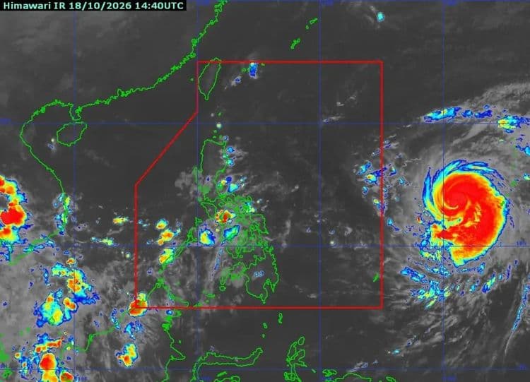
"Champi" is expected to enter the Philippine Area of Responsibility on Tuesday, Oct. 20.
The Philippine Atmospheric Geophysical and Astronomical Services Administration said the typhoon -- which in the latest advisory was located 1830 km east of Southeastern Luzon -- may enter in the morning or afternoon.
It is currently moving west northwestward at 15 kph.
Once it enters PAR, it will be given the domestic name "Rosal."
PAGASA said wind signals may be raised over the northern and eastern portions of Northern Luzon and portions of Bicol Region tomorrow evening or Tuesday morning.
Gusty conditions, PAGASA said, are likely to begin over most parts of Luzon and Visayas and portions of Mindanao by Wednesday.
The northern and eastern seaboards of Luzon and the eastern seaboards of Visayas and Mindanao are likely to have moderate to rough seas starting Wednesday.