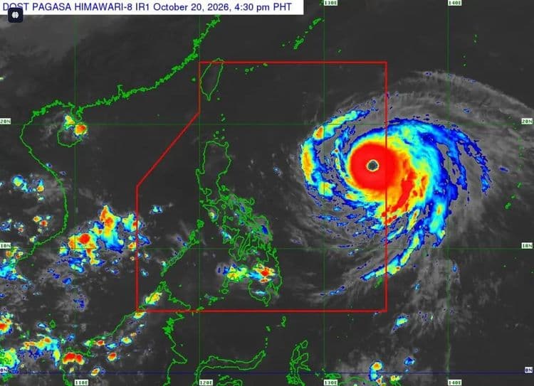
Signal No. 1 has been raised over parts of Luzon as the low pressure area east of Infanta, Quezon developed into a tropical depression on Saturday night.
The Philippine Atmospheric Geophysical and Astronomical Services Administration said the following areas are under the tropical cyclone wind signal with "Luis" so far located 360 km east of Daet, Camarines Norte:
Pollilo Islands
Northern portion of Camarines Norte (Daet, Talisay, Paracale, Jose Panganiban, Capalonga, Vinzons),
Northern portion of Catanduanes (Pandan, Caramoran, Bagamanoc, Panganiban)
"Luis" is packing maximum sustained winds of 45 km/h near the center and has a gustiness of up to 55 km/h.
PAGASA said it is moving westward at 15 km/h.
According to the weather bureau, the southwest monsoon and the periphery of "Luis" will also bring strong to gale-force gusts over Marinduque, Romblon, Caluya Islands, Siquijor, Southern Leyte, Camiguin, and Dinagat Islands tomorrow, Aug. 2.
On Monday, Aug. 3, most of Luzon and Visayas, Lanao del Norte, Camiguin, Surigao del Norte, and Dinagat Islands will experience the same conditions.
"Luis" is forecast to decelerate while moving west northwestward until tomorrow before turning east northeastward.
The center of "Luis" is expected to remain over the Philippine Sea.
"However, a westward shift of the forecast track, a landfall scenario or close approach to Northern Luzon is not ruled out," PAGASA said.