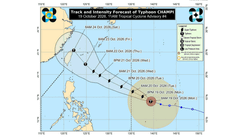
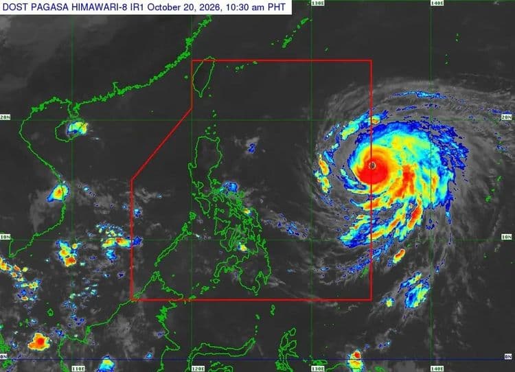
Signal No. 1 is now raised over parts of the country as Super Typhoon "Champi" entered the Philippine Area of Responsibility on Tuesday, Oct. 20.
The Philippine Atmospheric Geophysical and Astronomical Services Administration said the following areas are under the tropical cyclone wind signal with the eye of "Rosal" 1385 km east of Central Luzon:
-Batanes
-eastern portion of Babuyan Islands (Babuyan Islands, Camiguin, Didicas Islands)
-eastern portion of mainland Cagayan (Santa Ana, Gonzaga, Lal-Lo, Santa Teresita, Camalaniugan, Appari, Buguey, Gattaran, Baggao, Peñablanca)
-northeastern portion of Isabela (Maconacon, Divilacan, Palanan, San Pablo, Cabagan, Santa Maria, Tumauini, Ilagan City)
-northeastern portion of Catanduanes (Pandan, Viga Bagamanoc, Panganiban, Gigmoto)
PAGASA said the tropical cyclone is moving west northwestward at 25 kph.
The northeasterly windflow and the periphery of the tropical cyclone will also bring strong to gale-force gusts over Batanes, Ilocos Norte, Cagayan, Isabela, Polillo Islands, Camarines Norte, Camarines Sur, Catanduanes, Northern Samar, Eastern Samar, most of Caraga, Camiguin, Misamis Oriental, Sarangani, Davao del Sur and Davao Occidental.
A gale warning may also be issued over the northern and eastern seaboards of Northern Luzon and the eastern seaboards of Southern Luzon this afternoon or evening.
The super typhoon is generally expected to move west northwestward until tomorrow before moving generally northwestward until Friday morning.
It is forecast to exit PAR on Friday evening or early Saturday morning.