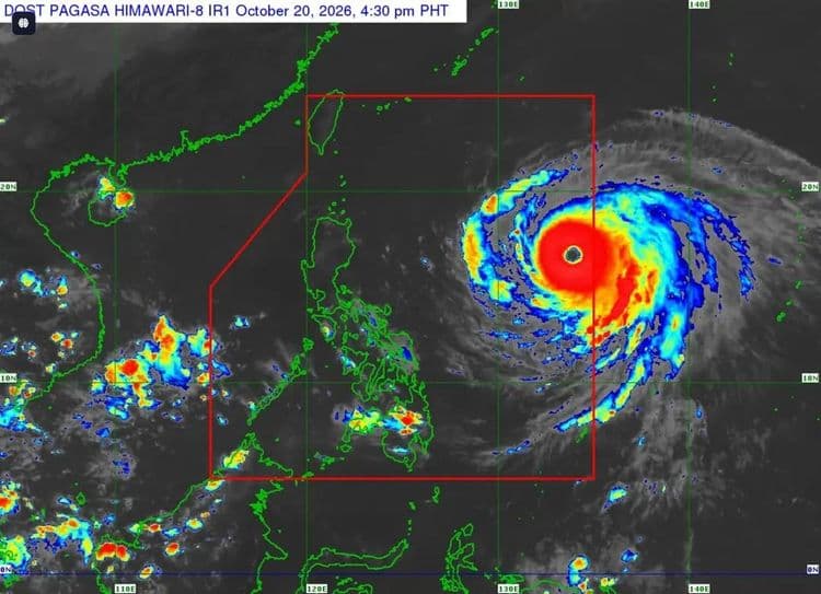
Super Typhoon "Rosal" slightly intensified on Tuesday, Oct. 20, as it moved west northwestward over the Philippine Sea.
The Philippine Atmospheric Geophysical and Astronomical Services Administration said Wind Signal No. 1 remains hoisted over parts of Luzon:
-Batanes
-Babuyan Islands
-northern portion of Ilocos Norte (Pagudpud)
-northern and eastern portions of mainland Cagayan (Santa Ana, Gonzaga, Lal-Lo, Santa Teresita, Camalaniugan, Aparri, Buguey, Gattaran, Baggao, Peñablanca, Santa Praxedes, Claveria, Sanchez-Mira, Pamplona, Ballesteros, Abulug, Allacapan)
-northeastern portion of Isabela (Maconacon, Divilacan, Palanan)
- northeastern portion of Catanduanes (Pandan, Bagamanoc, Panganiban, Gigmoto and Viga)
The eye of the super typhoon is so far located 1270 km east of Central Luzon.
It is packing maximum sustained winds of 195 kph near the center and a gustiness of up to 240 kph.
PAGASA said the northeasterly windflow and the periphery of "Rosal" will also bring strong to gale-force gusts over Batanes Ilocos Norte, Cagayan, Isabela, Polillo Islands, Camarines Norte, Camarines Sur, Catanduanes, Northern Samar, Eastern Samar, most of Caraga, Camiguin, Misamis Oriental, Sarangani, Davao del Sur and Davao Occidental today.
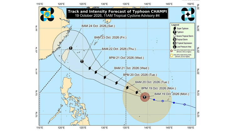
The super typhoon is expected to move generally west northwestward until tomorrow before moving northwestward until Friday morning.
It will be closest to extreme Northern Luzon between Thursday and Friday.