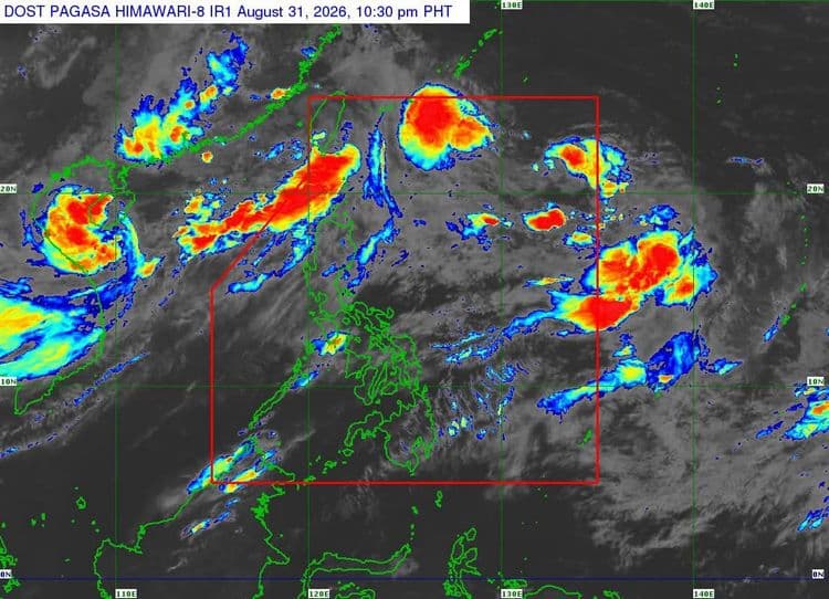
"Pilandok" maintained its strength on Monday, August 31, as it moved over the Philippine Sea east of extreme Northern Luzon.
The Philippine Atmospheric Geophysical and Astronomical Services Administration said that while no tropical cyclone wind signals are currently in place, the southwest monsoon will bring strong to gale-force gusts over most of the country today.
The same conditions will prevail over most of Luzon and Visayas, Zamboanga del Norte, Misamis Occidental, Lanao del Norte, Misamis Oriental, Camiguin, Dinagat Islands, Davao Occidental, and Davao Oriental on Tuesday and Wednesday.
PAGASA said "Pilandok" may become almost stationary over the Philippine Sea east of extreme Northern Luzon for the next 24 hours.
It will then move generally north northwestward for the remainder of the forecast period.
PAGASA said it is forecast to exit the Philippine Area of Responsibility (PAR) by Wednesday evening or Thursday morning.