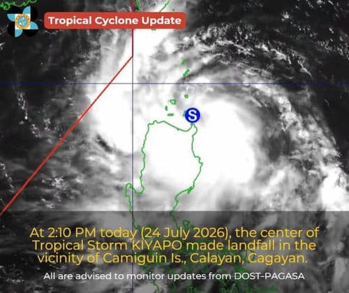
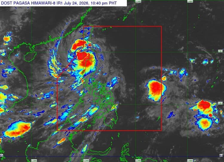
Batanes and the western portion of Babuyan Islands remain under Signal No. 2 as Severe Tropical Storm "Kiyapo" continued to intensify while traversing the West Philippine Sea on Friday night.
The Philippine Atmospheric Geophysical and Astronomical Services Administration said the following areas are also under Signal No. 1:
The rest of Cagayan
the northern portion of Isabela (Santo Tomas, Santa Maria, Quezon, Delfin Albano, San Pablo, Tumauini, Cabagan, Mallig, Maconacon, Quirino, Roxas)
Apayao
Abra
Kalinga
Mountain Province
Ilocos Norte
the northern and central portions of Ilocos Sur (Cabugao, Sinait, San Juan, Magsingal, Santo Domingo, Bantay, San Ildefonso, San Vicente, Gregorio del Pilar, San Esteban, Banayoyo, Cervantes, Burgos, City of Candon, Santa Lucia, Santiago, Santa Catalina, Lidlidda, Nagbukel, Suyo, Sigay, Galimuyod, Quirino, City of Vigan, San Emilio, Caoayan, Santa, Tagudin, Santa Cruz, Santa Maria, Narvacan, Salcedo, Alilem)
So far, the center of Severe Tropical Storm "Kiyapo" was estimated 140 km west northwest of Calayan, Cagayan.
"Kiyapo" is packing maximum sustained winds of 110 km/h near the center and has a gustiness of up to 135 km/h.
It is moving west northwestward at 30 km/h.
PAGASA said the southwest monsoon and the periphery of "Kiyapo" will also bring strong to gale-force gusts over most of the country on Friday.
On Saturday, most of Luzon, Western Visayas, Negros Island Region, Cebu, Northern Samar, Zamboanga del Norte, Sultan Kudarat, and Davao Oriental will experience the same conditions.
Batanes, Cagayan, Ilocos Region, Zambales, Bataan, Quezon, and MIMAROPA will also have the same conditions on Sunday.
A gale warning is in effect over the northern seaboard of Northern Luzon, PAGASA said.
"Kiyapo" will continue moving west northwestward over the West Philippine Sea until tomorrow Saturday morning before turning towards the southern mainland China.