
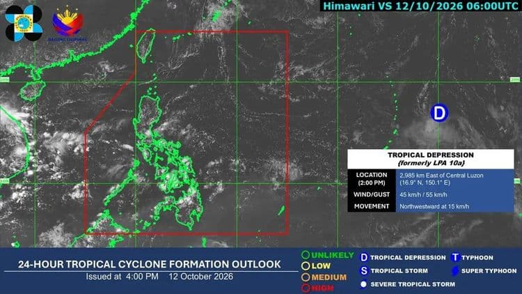
The Philippine Atmospheric Geophysical and Astronomical Services Administration is monitoring a tropical depression outside the Philippine Area of Responsibility.
PAGASA said the tropical cyclone is so far located 2985 km east of Central Luzon.
It is moving northwestward at 15 km/h.
PAGASA said cloudy skies with some rains are so far expected in parts of the country due to the northeasterly windflow affecting extreme Northern Luzon, the easterlies affecting the rest of Luzon and the eastern section of Visayas and localized thunderstorms.
Bicol Region, Eastern Visayas, Aurora and Quezon will have cloudy skies with scattered rains and thunderstorms, in particular.
Flashfloods or landslides due to moderate to at times heavy rains are possible.
Batanes and Babuyan Islands, meanwhile, will have partly cloudy to cloudy skies with isolated light rains.
Metro Manila, Ilocos Region, Cordillera Administrative Region, Occidental Mindoro, Oriental Mindoro, Marinduque, Romblon, the rest of Cagayan Valley, the rest of Central Luzon, and the rest of Calabarzon and the rest of the country will have partly cloudy to cloudy skies with isolated rain showers or thunderstorms.
PAGASA said Northern Luzon, Central Luzon and the eastern sections of Southern Luzon and Visayas will have moderate winds and moderate coastal waters.
The rest of the country will have light to moderate winds and slight to moderate coastal waters.