
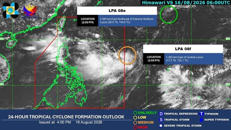
There is a "medium" chance the low pressure area off Central Luzon will develop into a tropical depression in the next 24 hours.
The Philippine Atmospheric Geophysical and Astronomical Services Administration said the LPA is so far located 1385 km east off Central Luzon.
So far a heavy rainfall outlook is issued for Ilocos Sur, La Union, Pangasinan, Benguet and Zambales due to the southwest monsoon affecting Luzon and the western section of Visayas.
Metro Manila, Cordillera Administrative Region, Ilocos Norte, Batanes, Cagayan, Nueva Vizcaya, Nueva Ecija, Tarlac, Pampanga, Bulacan, Cavite, Laguna, Batangas, Rizal, and Occidental Mindoro will have cloudy skies with scattered rains and thunderstorms.
Flash floods or landslides due to moderate to at times heavy rains are possible.
Visayas and the rest of Luzon, meanwhile, will have partly cloudy to cloudy skies with isolated rain showers or thunderstorms.
Mindanao will have partly cloudy to cloudy skies with isolated rain showers or thunderstorms due to localized thunderstorms.
According to PAGASA, the northern and western section of Luzon will have moderate to strong winds and moderate to rough coastal waters while the rest of the country will have light to moderate winds and slight to moderate coastal waters.