
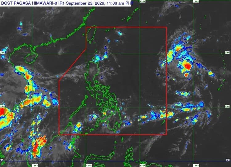
The tropical depression east of Southeastern Luzon is forecast to enter the Philippine Area of Responsibility on Thursday, Sept. 24.
The Philippine Atmospheric Geophysical and Astronomical Services Administration said once inside PAR, the tropical cyclone will be named "Queenie."
PAGASA said so far, the center of the tropical depression is located 1855 km east of Southeastern Luzon.
It is packing maximum sustained winds of 55 kph near the center and has a gustiness of up to 70 kph.
PAGASA said the tropical cyclone is expected to move west northwestward throughout the forecast period and may intensify into a tropical storm prior to its entry into PAR in the morning.
It may intensify into a typhoon by weekend, with further intensification possible.
Once inside PAR, PAGASA said the tropical cyclone is expected to move generally northwestward while near extreme Northern Luzon.