
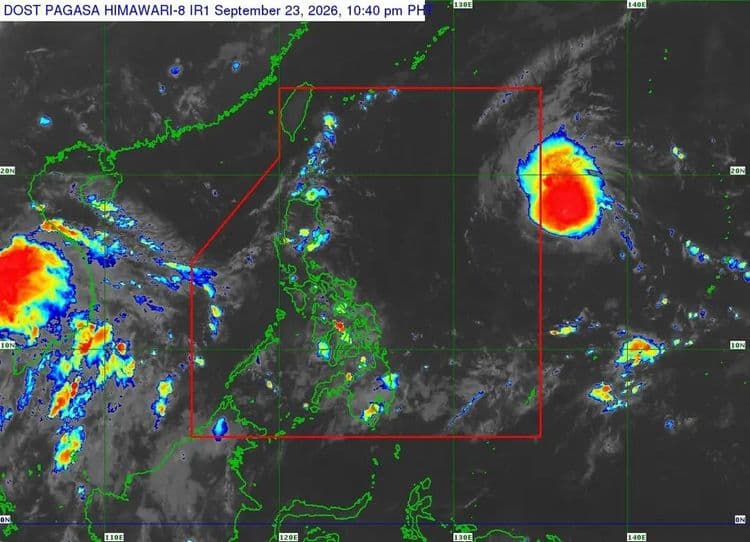
The tropical cyclone that is forecast to enter the Philippine Area of Responsibility on Thursday morning has intensified into a tropical storm.
The Philippine Atmospheric Geophysical and Astronomical Services Administration said TS "Surigae" is so far located 1695 km east of Northern Luzon.
It is packing maximum sustained winds of 65 kph and is moving west northwestward at 20 kph.
PAGASA said once it enters PAR, it will be given the local name "Queenie."
The tropical cyclone is expected to gradually intensify while inside PAR and may reach the typhoon category by Sunday.
It is not expected to directly affect the country's weather in the next three days but moderate seas are forecast over the eastern seaboard of Northern Luzon beginning Saturday.