
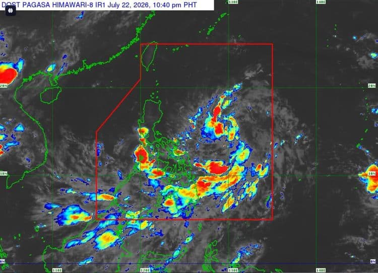
Signal No. 1 has been raised over parts of Luzon as the low pressure area off the southeastern portion of the main island developed into a tropical depression.
The Philippine Atmospheric Geophysical and Astronomical Services Administration said the following areas are under the tropical cyclone wind signal, with the center of "Kiyapo" estimated 1,080 km east of Southeastern Luzon:
the eastern portion of mainland Cagayan (Santa Ana, Gonzaga, Lal-Lo, Gattaran, Baggao, Peñablanca, Santa Teresita, Buguey)
the eastern portion of Isabela (Maconacon, San Pablo, Cabagan, Tumauini, Ilagan City, Divilacan, Palanan, San Mariano, Dinapigue)
PAGASA said "Kiyapo" was so far packing maximum sustained winds of 45 km/h near the center and has a gustiness of up to 55 km/h.
It is moving northwestward at 25 km/h.
According to PAGASA, the enhanced southwest monsoon and the periphery of "Kiyapo" will also bring strong to gale-force gusts over Sarangani, Davao Occidental, and Davao Oriental today.
Most of Mindanao, Siquijor, Bohol, and Southern Leyte will experience the same conditions on Thursday, July 23.
The same conditions will prevail over most of the country on Friday, July 24.
PAGASA said "Kiyapo" will move west northwestward to northwestward during the entire forecast period and may make a close approach or may make landfall over Babuyan Islands by Friday evening.
A landfall scenario over mainland Cagayan, however, is not ruled out.
"Afterwards, it will emerge over the Luzon Strait and is forecast to exit the Philippine Area of Responsibility by Saturday morning or noon," PAGASA said.