
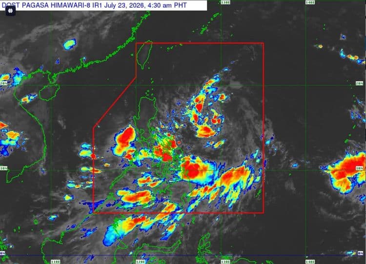
More areas in Luzon are now under Signal No. 1 as "Kiyapo" maintained is strength over the Philippine Sea on Thursday, July 23.
The Philippine Atmospheric Geophysical and Astronomical Services Administration said the following are under the tropical cyclone wind signal:
Batanes
Cagayan including Babuyan Islands
Isabela
Apayao
Abra
Kalinga
Eastern and central portions of Mountain Province (Paracelis, Natonin, Barlig, Sadanga, Bontoc, Besao, Sagada)
Eastern and central portions of Ifugao (Mayoyao, Aguinaldo, Alfonso Lista, Banaue, Hingyon, Lagawe)
Ilocos Norte
Northern portion of Ilocos Sur (Cabugao, Sinait, San Juan, Magsingal, Santo Domingo, Bantay, San Ildefonso, San Vicente)
the northern portion of Aurora (Dilasag, Casiguran)
PAGASA said the center of Tropical Depression "Kiyapo" was so far estimated 950 km east of Central Luzon.
It is packing maximum sustained winds of 45 km/h near the center, and has a gustiness of up to 55 km/h.
It is moving west northwestward at 20 km/h.
PAGASA said the southwest monsoon and the periphery of "Kiyapo" will bring strong to gale-force gusts over most of Mindanao, Siquijor, Bohol, and Southern Leyte today, with most of the country experiencing the same conditions tomorrow.
Most of Luzon, most of Visayas, Zamboanga Peninsula, Misamis Occidental, Camiguin, Dinagat Islands, and Davao Oriental will have the same conditions on Saturday.
PAGASA said "Kiyapo" will continue moving west northwestward toward the Luzon Strait before turning northwestward.
It may stride very close to the northeastern portion of mainland Cagayan between tomorrow morning and afternoon, and do the same or make landfall in the vicinity of Babuyan Islands between tomorrow afternoon and evening.
The weather bureau said "Kiyapo" is forecast to exit the Philippine Area of Responsibility by Saturday morning or noon.