
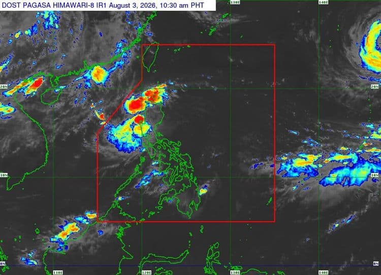
Signal No. 1 remains hoisted over parts of Luzon even as "Luis" slightly weakened as it moved northwestward over the Philippine Sea.
The Philippine Atmospheric Geophysical and Astronomical Services Administration said the following areas are under the tropical cyclone wind signal with the center of Tropical Depression "Luis" located 165 km east of Echague, Isabela:
The central and eastern portions of Cagayan (Enrile, Tuguegarao City, Peñablanca, Piat, Santo Niño, Camalaniugan, Tuao, Lal-Lo, Gonzaga, Alcala, Amulung, Santa Teresita, Baggao, Buguey, Solana, Rizal, Santa Ana, Gattaran, Iguig, Lasam, Aparri, Ballesteros, Abulug, Allacapan, Pamplona)
Isabela
Quirino
Eastern and southern portions of Apayao (Flora, Santa Marcela, Conner, Pudtol, Luna), the eastern portion of Kalinga (City of Tabuk, Tanudan, Pinukpuk, Rizal)
Eastern portion of Mountain Province (Paracelis, Natonin)
Eastern portion of Ifugao (Aguinaldo, Alfonso Lista)
Northern portion of Aurora (Dinalungan, Casiguran, Dilasag, Dipaculao, Baler)
"Luis" is packing maximum sustained winds of 45 km/h near the center and has a gustiness of up to 55 km/h.
It is moving northward at 15 km/h.
PAGASA said the southwest monsoon and the periphery of "Luis" will also bring strong to gale-force gusts over most of Luzon and Visayas, Zamboanga del Norte, Lanao del Norte, Misamis Occidental, Camiguin, Surigao del Norte, Dinagat Islands, Sarangani, Davao Occidental, and Davao Oriental today and tomorrow.
On Wednesday, most of the country will experience the same conditions.
PAGASA said "Luis" may make landfall or pass close to Northern Luzon tonight or tomorrow morning.
"Afterwards, it will sharply turn east northeastward while moving away from the Philippine landmass," PAGASA said.