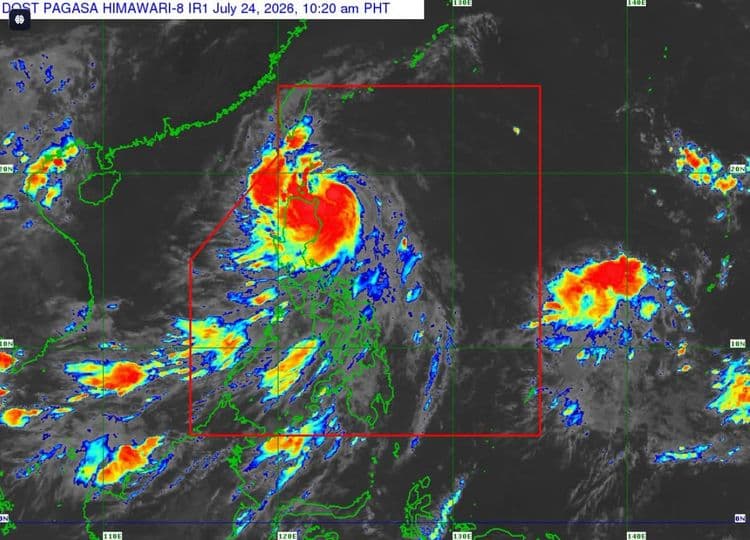
Parts of the country remain under tropical cyclone wind signals on Friday, July 24, as "Kiyapo" slightly intensified and moved closer to extreme Northern Luzon.
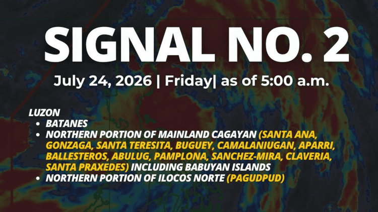
The Philippine Atmospheric Geophysical and Astronomical Services Administration said the following areas are under Signal No. 2:
Batanes
the northern portion of Cagayan (Santa Ana, Gonzaga, Santa Teresita, Camalaniugan, Aparri, Ballesteros, Abulug, Pamplona, Sanchez-Mira, Claveria, Santa Praxedes, Buguey, Allacapan, Lal-Lo, Gattaran, Baggao, Lasam) including Babuyan Islands
the northern portion of Apayao (Luna, Santa Marcela, Calanasan, Pudtol, Flora)
the northern portion of Ilocos Norte (Pagudpud, Dumalneg, Adams, Bangui, Burgos, Vintar).
The following areas, meanwhile, are under Signal No. 1:
The rest of mainland Cagayan
Isabela
Quirino
Nueva Vizcaya
Rest of Apayao
Abra
Kalinga
Mountain Province
Ifugao
Benguet
Rest of Ilocos Norte
Ilocos Sur
La Union
Northern and central portions of Aurora (Dilasag, Casiguran, Dinalungan, Dipaculao)
The center of Tropical Storm "Kiyapo" is so far estimated based 135 km east of Aparri, Cagayan, PAGASA said.
"Kiyapo" is packing maximum sustained winds of 75 km/h near the center and has a gustiness of up to 90 km/h.
It is moving westward at 30 km/h.
PAGASA said the southwest monsoon and the periphery of "Kiyapo" will bring strong to gale-force gusts over most of the country today.
The same conditions will prevail over most of Luzon and Visayas, Zamboanga del Norte, and Davao Oriental tomorrow and over Ilocos Region, MIMAROPA, Zambales, Bataan, and Quezon on Sunday.
According to PAGASA, a gale warning is in effect over the northern seaboard of Northern Luzon.
"Kiyapo" is expected to continue moving west northwestward until tomorrow towards the Luzon Strait before turning northwestward to northward for the remaining forecast period.
"On the forecast track, the center of "Kiyapo" may pass close to the northeastern portion of mainland Cagayan between this morning and afternoon, then pass very close or make landfall in the vicinity of Babuyan Islands between this afternoon and evening," PAGASA said.
It said the tropical cyclone is forecast to exit the Philippine Area of Responsibility by tomorrow morning.