
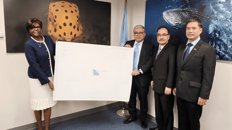
Pormal nang idineposito ng Pilipinas ang nautical chart ng Panatag (Scarborough) Shoal sa United Nations (UN) Secretariat nito lamang Hulyo 29, 2026. Ang hakbang na ito ay alinsunod sa Article 16 ng 1982 UN Convention on the Law of the Sea (UNCLOS) upang ipaalam sa international community ang eksaktong sakop, baselines, at hurisdiksyon ng bansa.
Personal na iniharap nina Philippine Ambassador to the UN Enrique Manalo at National Mapping and Resource Information Authority (NAMRIA) Administrator Peter Tiangco, kasama ang mga legal at maritime experts mula sa Department of Justice (DOJ) at Office of the Solicitor General (OSG) ang NAMRIA Chart No. 1567 na pinamagatang “Bajo de Masinloc and Approach” kay Alice Hicuburundi, ang deputy director ng UN Division for Ocean Affairs and the Law of the Sea (DOALOS).
Bago pa ito, kinuwestiyon ni Senador Rodante Marcoleta sa isang panayam noong Pebrero 10, 2026 ang NAMRIA kung bakit lumipas ang mahigit isang dekada nang walang pormal na pagsusumite ang bansa sa UN.
“Can you imagine, 14 years after the administrative order in 2012 was issued by President PNoy, ordering NAMRIA to prepare the maps and chart in consultation with the DFA to submit it to the office of the UN Secretary General, because that is the only way to notify the whole world that you have a claim,” ani Marcoleta.
Tinukoy ng senador ang Administrative Order (A.O.) No. 29 na nilagdaan pa noong 2012 ni dating Pangulong Benigno "Noynoy" Aquino III na nag-aatas sa NAMRIA at DFA na ihanda at ideposito ang mapa sa UN.
“Kaya hinahamon ko ang NAMRIA, ipatatawag natin ang NAMRIA bakit hirap na hirap kayo, after 14 years, you have not submitted, you have not complied with the administrative order no. 29?” giit niya.
Kasalukuyang nakapiit ang senador dahil sa kasong isinampa ng Office of the Ombudsman.