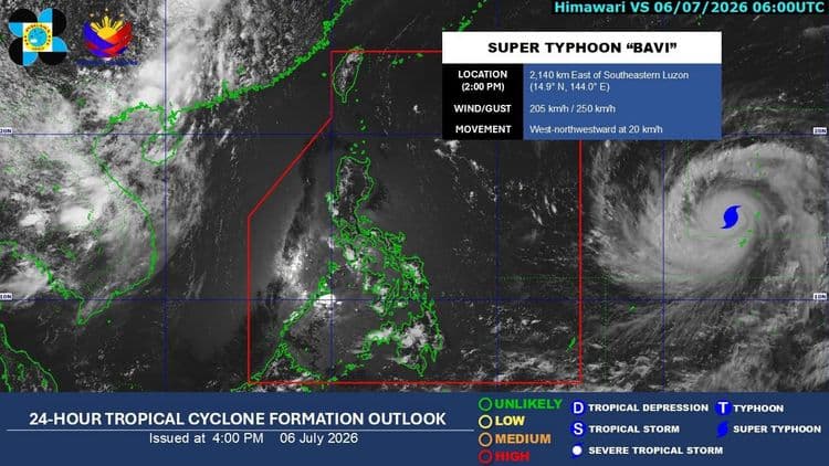
MANILA, Philippines — Super Typhoon "Bavi" (international name) continues to head toward the Philippine Area of Responsibility (PAR) and is expected to enter the boundary between Tuesday evening, July 7, and early Wednesday morning, July 8, according to the state weather bureau.
Once it enters PAR, the powerful weather disturbance will be given the local name "Inday"—making it the ninth tropical cyclone to hit the country this year.
According to PAGASA weather specialist Aldczar Aurelio, the center of the super typhoon was last tracked moving west-northwestward at 15 kilometers per hour (kph). It maintains maximum sustained winds of 215 kph near the center and gustiness of up to 265 kph.
No direct landfall, but wind signals possible
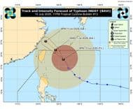
While Bavi is highly unlikely to make landfall anywhere on the Philippine landmass—with its projected track heading toward Taiwan—its massive size means parts of the country will still feel its impact.
PAGASA warned that Tropical Cyclone Wind Signals (TCWS) could be raised over the northern and eastern portions of Northern Luzon as early as Tuesday night or Wednesday morning, potentially reaching Signal No. 2 or 3 as it passes close to Batanes.
What to expect this week:
Tuesday to Wednesday: Extreme Northern Luzon may begin experiencing gusty conditions. Meanwhile, a ridge of a High Pressure Area (HPA) will bring warm, generally fair weather to the rest of the country, punctuated only by isolated afternoon or evening localized thunderstorms.
Thursday onward: As the super typhoon draws closer, its strong circulation is forecast to enhance the southwest monsoon (habagat). This will pull heavy, continuous rains across the western sections of Luzon and Visayas, lasting through the weekend.
PAGASA advises the public to stay alert for sudden downpours during localized thunderstorms, which could still trigger flash floods or landslides in low-lying and mountainous areas.
Posted by: Alma Angeles/NET25 News