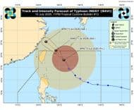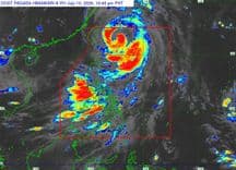
The service warned residents to take cover as the Category 5 storm moved through the island chain, parts of which are the U.S. Commonwealth of the Northern Mariana Islands and the U.S. territory of Guam, about 3,800 miles (6,116 km) west of Hawaii and 1,550 miles (2,494 km) east of the Philippines.
Eyewitness footage shot from Guam's beachside neighbourhood Apotgan showed heavy winds and rains lashing trees, tennis courts and buildings on Monday.
Reuters was able to confirm the location and date of the video from metadata on the original file. Terrain, buildings, tennis courts, and vegetation seen in the video also matched satellite and archive imagery of the area.
The NWS said Bavi's eyewall was expected to make landfall at Rota shortly after dawn local time, with "catastrophically destructive" winds up to 180 miles per hour (290 kph). Gusts to 215 mph were possible. The islands of Guam, Tinian and Saipan were expected to see conditions ranging from severe tropical storm to typhoon on Monday before winds began easing.
The U.S. islands are a strategic defence hub in the western Pacific, hosting U.S. military training facilities and bases including Andersen Air Force Base, Naval Base Guam and Marine Corps Base Camp Blaz.
Posted by: Alma Angeles/NET25 News